Gobustan district was acting as the administrative territorial unit of Maraza during 1920-1930. After establishment of Shamakhi region in 1930, Maraza was joined to the region. Later in 1943 Maraza was detached from Shamakhi and functioned as a separate region till January 1960. Last time Maraza was separated from Shamakhi in April 1990 and Gobustan district was formed. Gobustan settlement was established in 1893, near Duvanni railway station with the purpose of export of of oil abroad. For the first time Azerbaijan oil was carried out from this station in 1901. Duvanni settlement was formed on the basis of Sangachal, Cheildagh, Alat and Atbulag settlements in 1950 -1954 and after the region was again joined to Molotov region (now Garadagh) in 1956.
RELIEF:
Gobustan region is located in the East of Azerbaijan in low mountains in South-East end of Great Caucasus. The area borders with Southern slope of Major Caucasus in the North, Pirsaat River and its tributary Ajidara River and Aladash plateau in the West, Girdadagh (548 m), Harami (300 m) and Mishov mountains (mud volcanoes) in the South, Gungurdagh (676 m), Kechigaya (641 m) and Böyük Siyaku (786 m) low mountains in the East. The average height of the region is 600-700 meters and maximum height is 1500 meters. The main confluents of the Great Caucasus ridge Aladash, Kamchi, Takhtayaylag (Gumbudag 1286 m, Katandagh 980 m, Yurtandagh 898 m) are located in the Northern part of the territory. The climate of the area based on dry summers with temperate semi-desert and dry – steppe climates. The annual precipitation is 500 mm in the North, though it is 150 mm and less in South and South – Eastern areas. The peaks of the area are Qushludagh (1421 m), Qushudagh (1368 m), Arpa-bulag (1356 m) in the North -East, Shesni – Shaytan (1241 m) in the East and Gumbudag (1286 m) in the North.

GEOLOGICAL STRUCTURE:
Though the sediments of Cretaceous period spread in the North part of the territory, the rest of the area is covered with Paleogen, Neocene and Anthropogenic sediments.

RIVER AND WATER BASINS:
The river network in the region is the most sparse compared with other parts of the Republic. The rivers start from different heights such as: Pirsaat, Gozluchay, Jeyrankechmaz, Gilgilchay, Gangichay and Sumgaitchay rivers. The source of the Pirsaat comes from the Eastern edge of Great Caucasus (2400 m) and Sumgaitchay begins at 2000 meters height (Gulumdostu daghi). Jeirankechmaz begins not far from Arab – Sahverdi village (800 m) and flows into the Caspian Sea near Sangachal station. The Gilgilchay begins from the slope of Gulumdostu mountain (1980 m). Khilmilli, Nabur, Sundu, Jeirly, Chalov, Takla and Chukhali villages abound with mineral waters.

LANDSCAPES AND BIODIVERSITY:
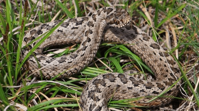
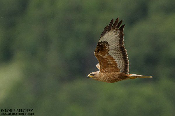
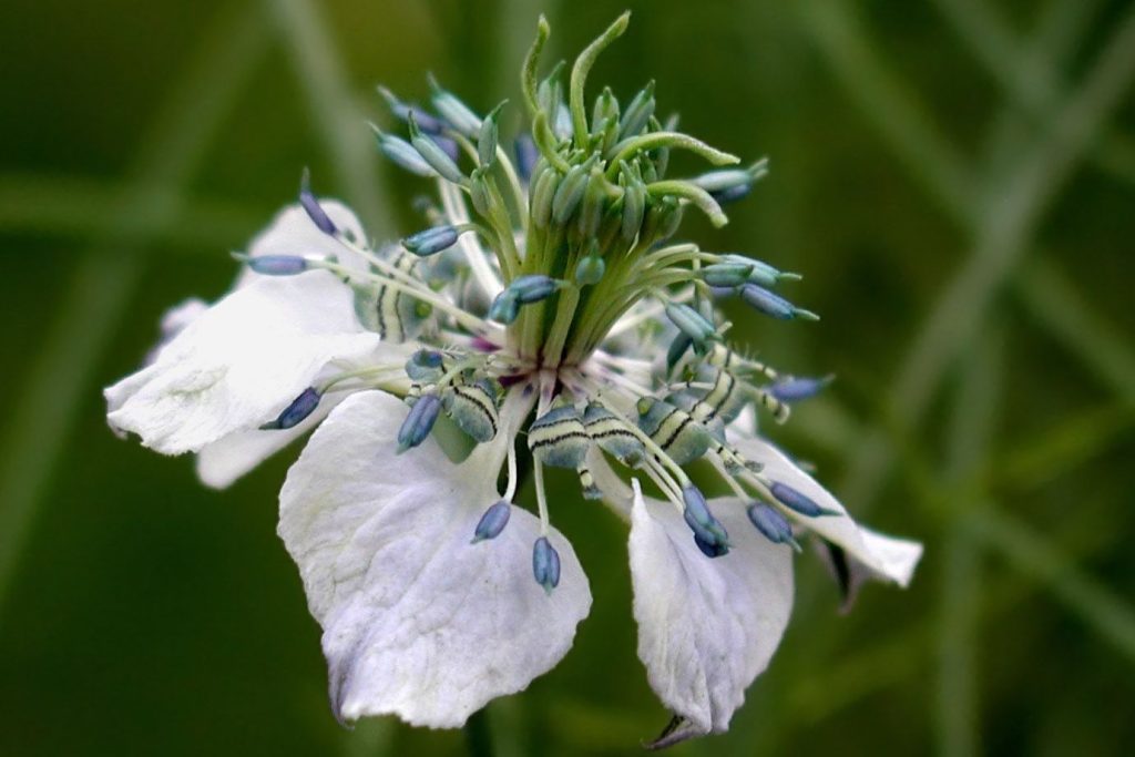
The main soil of the area is brown, light-brown, gray-brown and gray-brown-saline. Gobustan with a number pastures is one of the main winter camps of Azerbaijan. The semi-desert and dry steppe moderate warm climate is dominated. The climate is mild hot in the Northern part of the area. The average temperature is 1.5 ° C to 3 ° C in January and up to 27° C in July. Annual precipitation is approximately 500 mm in the North-West and 150 mm or less in the South-Eastern part of the territory. Mountainous xerophytes, semi-desert and dry steppe vegetations occupy an extensive area in the region. The characteristic animals of the region are: fox, wolf, brown rabbit, field mouse, snake, lizard, etc. The bird species are: partridge, pigeon, etc.
HISTORY:
Gobustan, one of the ancient dwelling settlements of Azerbaijan was the part of Shirvan historical province. The origin of the word “gobu” (gobi) comes from Turkish word and the meaning is dry, thirsty land, country or hamlet. “Gobu” means dry or dry valley with temporary water flow, ravine in landscaping. According to other sources, the word “Gobu” has not any correspondence with this place. However, from point of the Arabic origin the word comes from “gabustan” which means saint place.
The word is composed of two syllables “Qabu” close to God and “Stan” is the meaning of the location. “Qabustan” or “Qabistan” means a place close to God. Thus, “Qabistan” attains to sacred name and meaning. According to the old and religious people in summer “white road ” is seen in the sky of Gobustan. This who was going to Kaaba for ” Hadj pilgrimage ” were using this as compass in the past. Maraza settlement the centre of Gobustan region is located in the central plateau of Maraza, along the main road. As for the legends, the word “Maraza” comes from the name of the one famous man’s wife who was seriously ill and was healed here. According to other version the word “Maraza” means “Merz” – border, boundary.
NATURAL MONUMENTS AND CULTURAL HERITAGE:
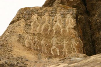
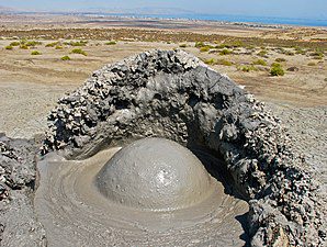
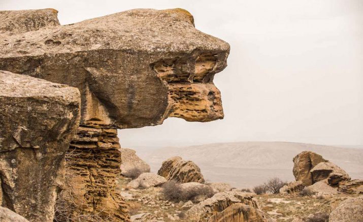
This area is rich with cultural, biological and geological natural monuments. The most beautiful and largest mud volcanoes of the world and Azerbaijan are situated in this region. The most interesting geological natural monuments of the area: Carst cave in Narimankand (“Cave Propher”), carst caves in the Sudlu village (“Kuhuldagh”), “Kuhul” in Poladli village and “Crying Rock” with an interesting legend and mud volcanoes very beautiful and majestic in Sundu village. Nardaran – Akhtarma (Nardaran village), Ilanli (Shikhzahirli village) and Chayirli (Chayirli village) are interesting volcanoes of the area.
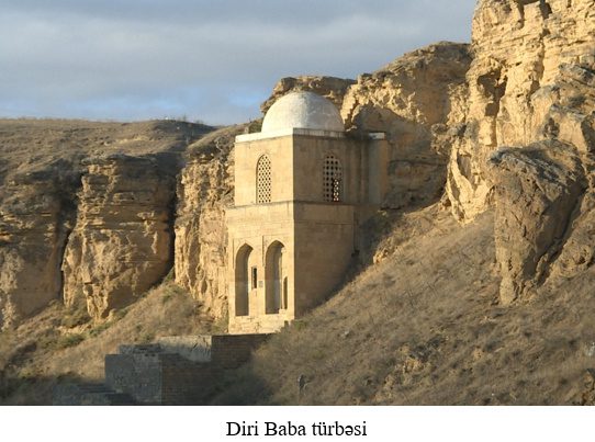
Gobustan sacral areas are also famous for the sacred mountains as: Bayanata, Gaibler and Shaibler mountains. There are Saint (Sacrau) graves on the top of the mountains. Moreovey, there are Sufi graves, more than 70 pilgrimage, holy places, tombs (“Diri – Baba” in Maraza 1402), tomb of Pir – Abdulkarim in Nabur village, South – Hamid Tomb (XIV century) considered sacred and healing, Sheikh Ayyub Tomb (XVII century) is located in the territory.
Besides, the ancient mosques (Sundu village, XIV century), caravanserais (Shah – Abbas caravanserai in Maraza, the remains of caravanserai in Khilmilli), ancient fortresses ( Gavurgala in Jayirli village, Navurgala in Nabur village,
“Javanshir Tower ” in Shiklar, castles in Badalli and Kolani villages), the ancient settlements (Sheyborku near Dagh Kolani village in Allah – Akbar mountain, rock houses
“Kuhul ” in Poladli village, Shahargah in the Gilijan area) are historical ornaments of the region. “Diri-Baba” tomb is peculiar among these monuments. Eastern and Europe travelers and diplomats as Adam Oleari, Kornelius Də Bruijin, and eminent Turkish traveler Evliyya Chalabi report on this tomb. The initial form of the monument have been built in unreachable rocks and looked like a feudal castle. The tomb in the form of square domes was built by the order of Shirvanshah Sheikh Ibrahim and the president of Egypt Republic G.Abdul Naser visited the tomb in 1965 during his visit to Azerbaijan and asked Soviet leaders to restorf the monument. According to suppositions the person with the name Mohammad was sent to jurisdiction of Ibrahim Khan as religious propagander. As an award to the guest’s action, Ibrahim Khan introduced Maraza region to him as a present.
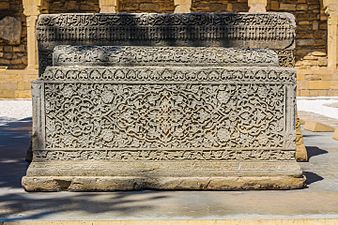
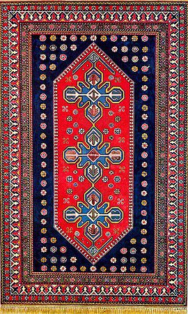
The mosque of joining Islam with manteism and considering as hurifi mosque (XIV century) locates near Sundu Village. In accordance with substitudes the mosque with the coeval of hurufi Sheikh Imameddin Nasimi (1369-1417) situates in Halab. The giant slab of sculpted stone monuments on the graves with the 2.5 – 3 m length are feasible in one of the ancient cemetaries of the former Islam period. Qobustan region is has been always distinguished by local carpets as “Maraza”, “Nabir”, “Chuxanli”, “Camcamli”, it used to be centre of Shirvan carpet – weaving as well.
ARCHAEOLOGICAL MONUMENTS:
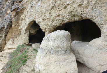
Gobustan residence of the Middle Ages near the settlement of Maraza, Kolani residence of the ancient period near Poladli village, Sherar necropolis, pitcher tombs considering to ancient period near Bakla village, ancient cemetery near Chalov village, Chalov residence related to early Middle Ages, Jairli residence of early Middle Ages near Jairli village. Shikhzahirli gravel mounds of early Middle Ages near Shikhzahirli village. Gadirtapa gravel mounds of Bronze Age near Gundu village, Guyulu caves in Gahla mountain and caves of the middle ages.
Official source: Azerbaijan Ecotourism Potential
Qarib Mammadov, Elman Yusifov, Mahmud Khalilov, Vuqar Karimov

