

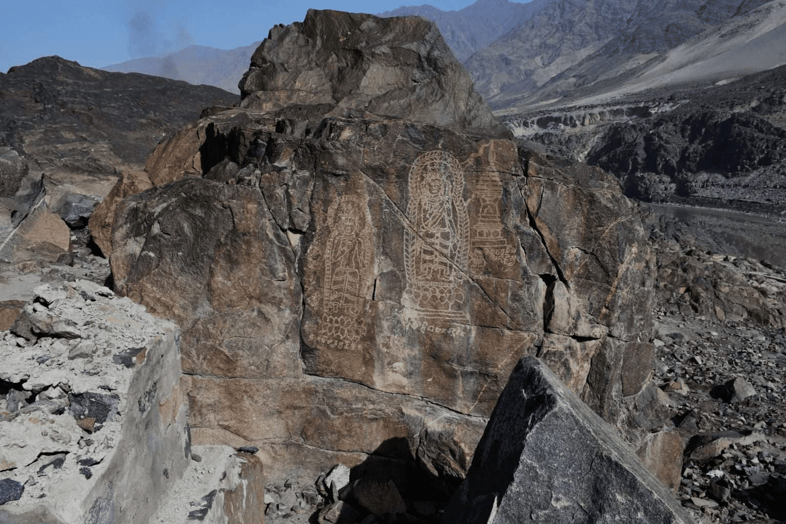
The Shatial petroglyphs of the Gilgit-Baltistan area around the Karakoram Highway, Pakistan
The ancient route of the Silk Road runs in the north of Pakistan. They converged among the mighty Karakoram, Himalayas and
Hindu Kush Ridges connecting China and Central Asia with Indo-Pak subcontinent. For thousands of years, travelers, invaders, missionaries, traders, pilgrims, and artisans from different cultures have entered the region along the legendary Silk Road and its branches. The signs of these visitors remaining on this land can be seen in the cave paintings, culture, knowledge and social practices of the region for this day. One of the most interesting remnants of the meeting of civilizations is the ancient rock carvings found on boulders and rocks of the region. The sheer variety of style and symbolism has made this area one of the most important centers of ancient petroglyphs in the world.

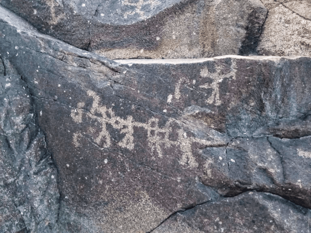
Gilgit-Baltistan, Chilas Site
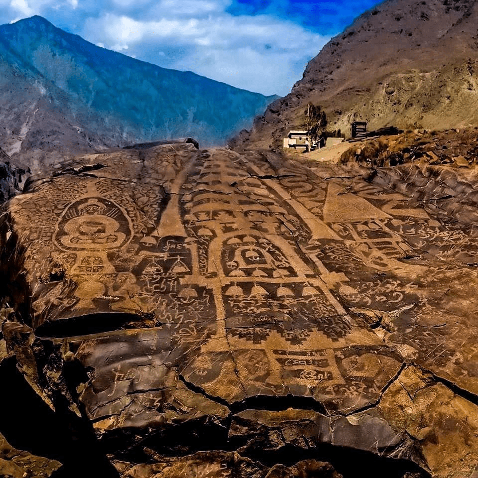
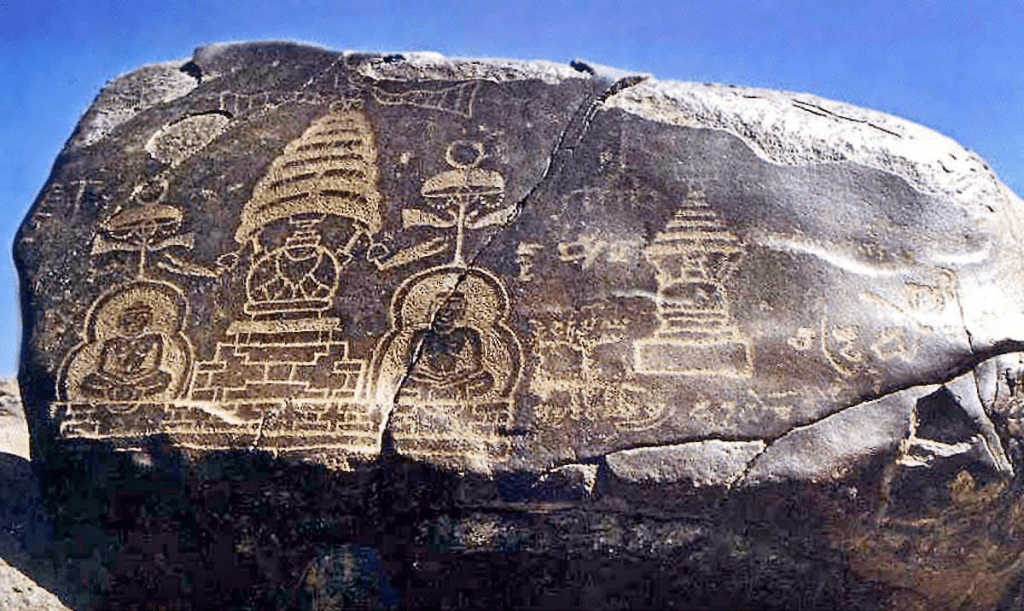
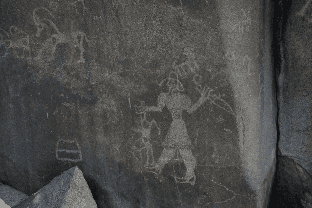
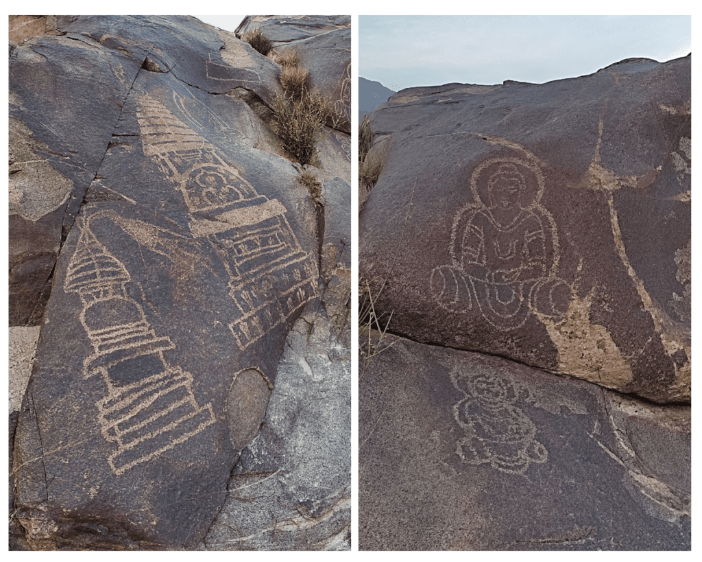
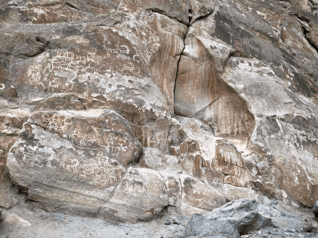
In 1978, the Karakoram Highway was opened with a length of 750 km, which cut through the mountain ranges of the Himalayas and Karakoram to connect Pakistan and China and become the highest paved road in the world. This road has opened a new passage through hilly areas that have been a cultural melting pot for humanity for millennia. In 1980 , the German scholar Karl Jettmar and renowned Pakistani archaeologist, Professor Ahmed Hassan Dani organized a Pakistani-German Archaeological Mission to the Northern Regions to systematically explore the vast wealth of ancient rock art in the region and introduce it to the world. In the area stretching for about 100 km between the Shastal and Raikot bridges on the Karakoram Highway, there is an extensive gallery of ancient rock art in the open air. More than 50,000 rock carvings and 5,000 inscriptions have been recorded dating from the 9th century BC to the 16th century BC, that is, some of them are almost 2,900 years old. The carvings depict animals, triangular human figures, Buddhist images and hunting scenes – often animals are depicted larger than hunters. The earliest drawings show signs that they were carved with stone tools, and later Buddhist images were added using sharp metal tools, which is a clear indicator of the development of tools and technologies in the region. The ancient scripts include Kharoshti, Brahmi, Sogdian, Chinese, Tibetan, pro-sharada and even Hebrew. Most of the works are written in Brahmi script. These inscriptions are a vital source for understanding the religious, social and political situation of the past culture and communities and visitors of the region. In addition, some inscriptions mention dates and names of rulers, which allows scientists to better understand the chronology of the history of the region. The variety of rock carvings is also an indicator of the strategic importance of this region, which has forced so many people – in time and culture – to pass through this land. The cave paintings contain a whole magnificent chapter of human evolution, and it’s time for us to make a collective effort to understand the stories they have been trying to share with the world for millennia.
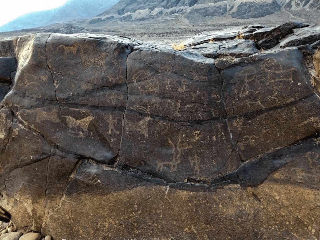
Gilgit Baltistan, Hodur Site
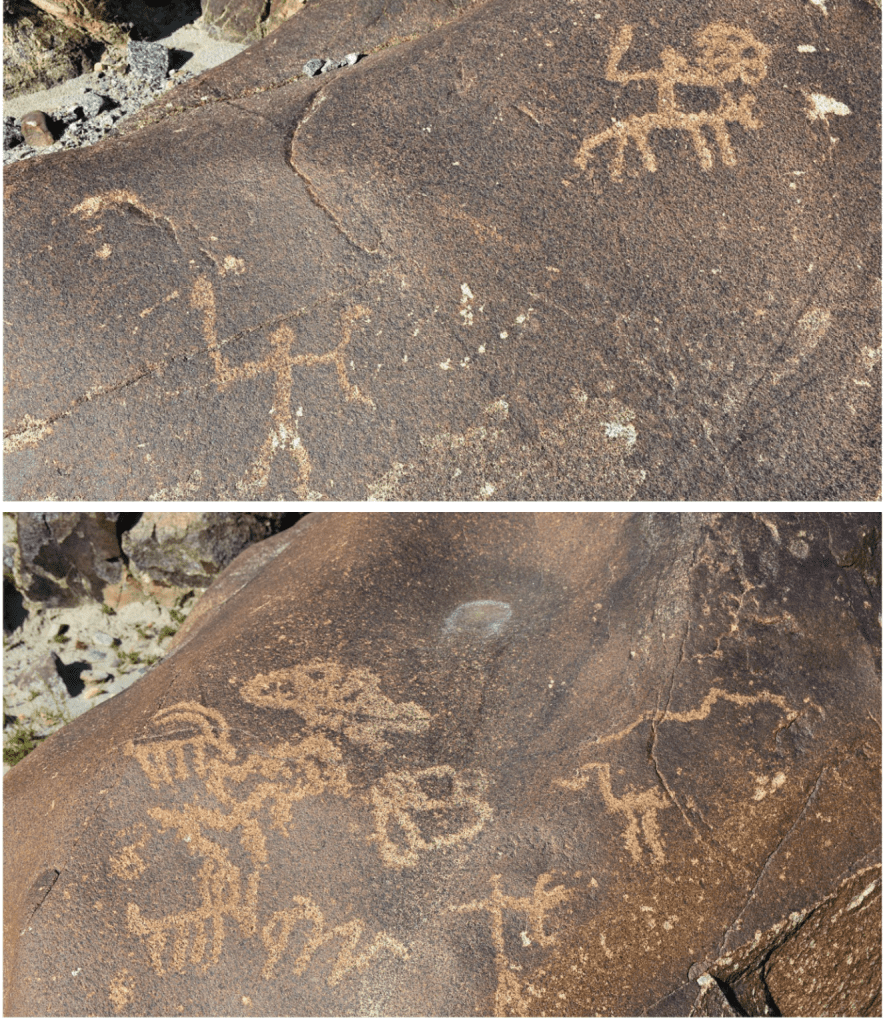
Gilgit-Baltistan,Thalpan Site
Gilgit Baltistan, Oshibat Site
Gilgit Baltistan, Gichi Nullah Site
Chilas Town, Minar Gah Site
Right Bank of Indus River along Karakoram Highway, Shing Nullah Site
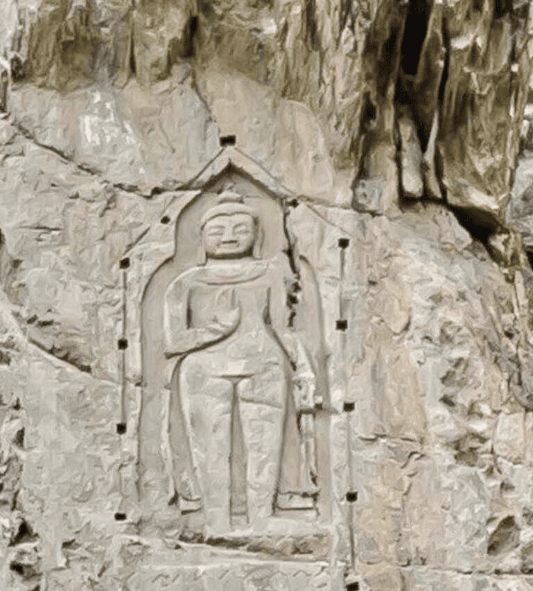
Kargah Nullah about 6 km west of Gilgit city on the road to Ghizar Valley, Kargah Buddha Site
Sacred Rock of Hunza
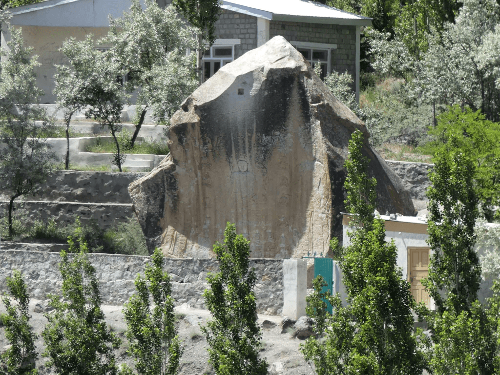
Manthal Bhuddha Rock, Skardu
The main themes at the Shatal, Thor, Hodur, Oshibat, Gichi Nullah, Minar Gah, Chilas, Thalpan, Shing Nullah, Karga Buddha sites rock art site include animals, humans, and handprints.
SOURCE: www.tourism.gov.pk